Awesome image!:
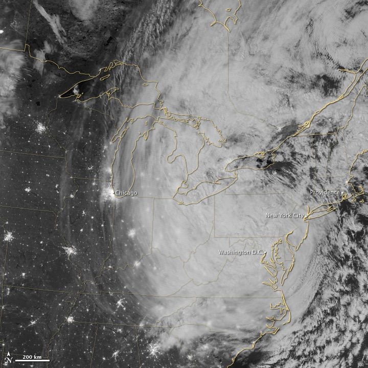
The Visible Infrared Imaging Radiometer Suite (VIIRS) on the Suomi NPP satellite acquired this image of the storm around 3:35 a.m. Eastern Daylight Time (7:35 Universal Time) on October 30. This image is from the “day-night band” on VIIRS, which detects light wavelengths from green to near-infrared. The full Moon, which exacerbated the water height at the time of the storm surge, lit up the tops of the clouds.
Sandy’s clouds stretched from the Atlantic Ocean westward to Chicago. Clusters of lights gave away the locations of cities throughout the region, but along the East Coast, clouds obscured city lights, many of which were out due to the storm.
No comments:
Post a Comment